4 min read

By Lauren Perkins
When you think of NASA, disasters such as hurricanes may not be the first thing to come to mind, but several NASA programs are building tools and advancing science to help communities make more informed decisions for disaster planning.
Empowered by NASA’s commitment to open science, the NASA Disasters Program supports disaster risk reduction, response, and recovery. A core element of the Disasters Program is providing trusted, timely, and actionable data to aid organizations actively responding to disasters.
Hurricane Ida made landfall in Louisiana Aug. 21, 2021, as a category 4 hurricane, one of the deadliest and most destructive hurricanes in the continental United States on record. The effects of the storm were widespread, causing devastating damage and affecting the lives of millions of people.
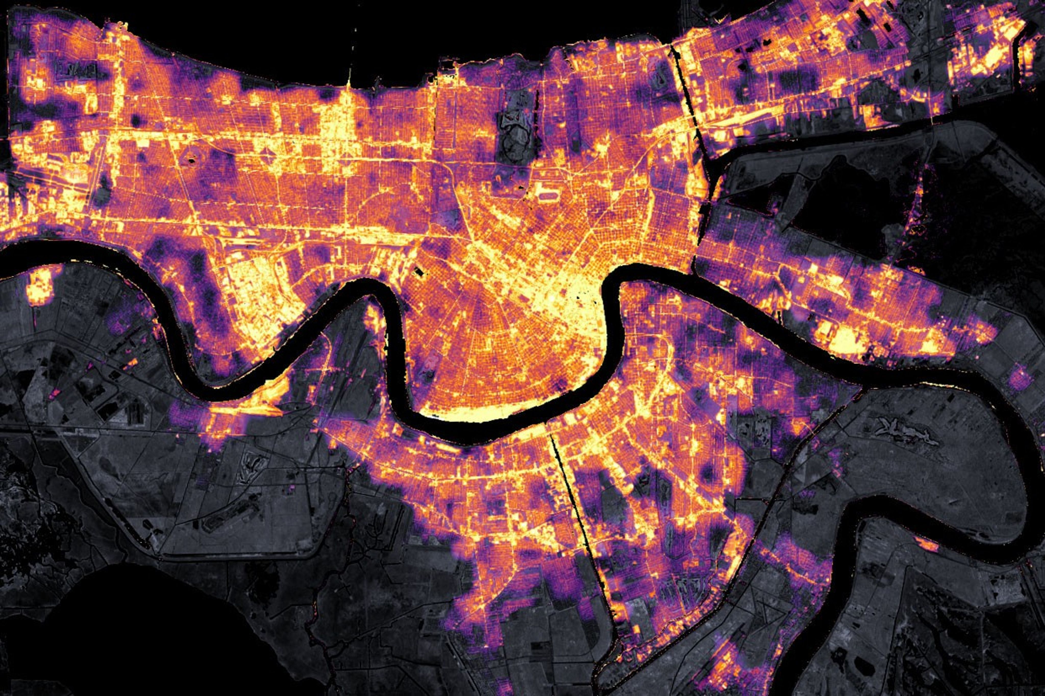
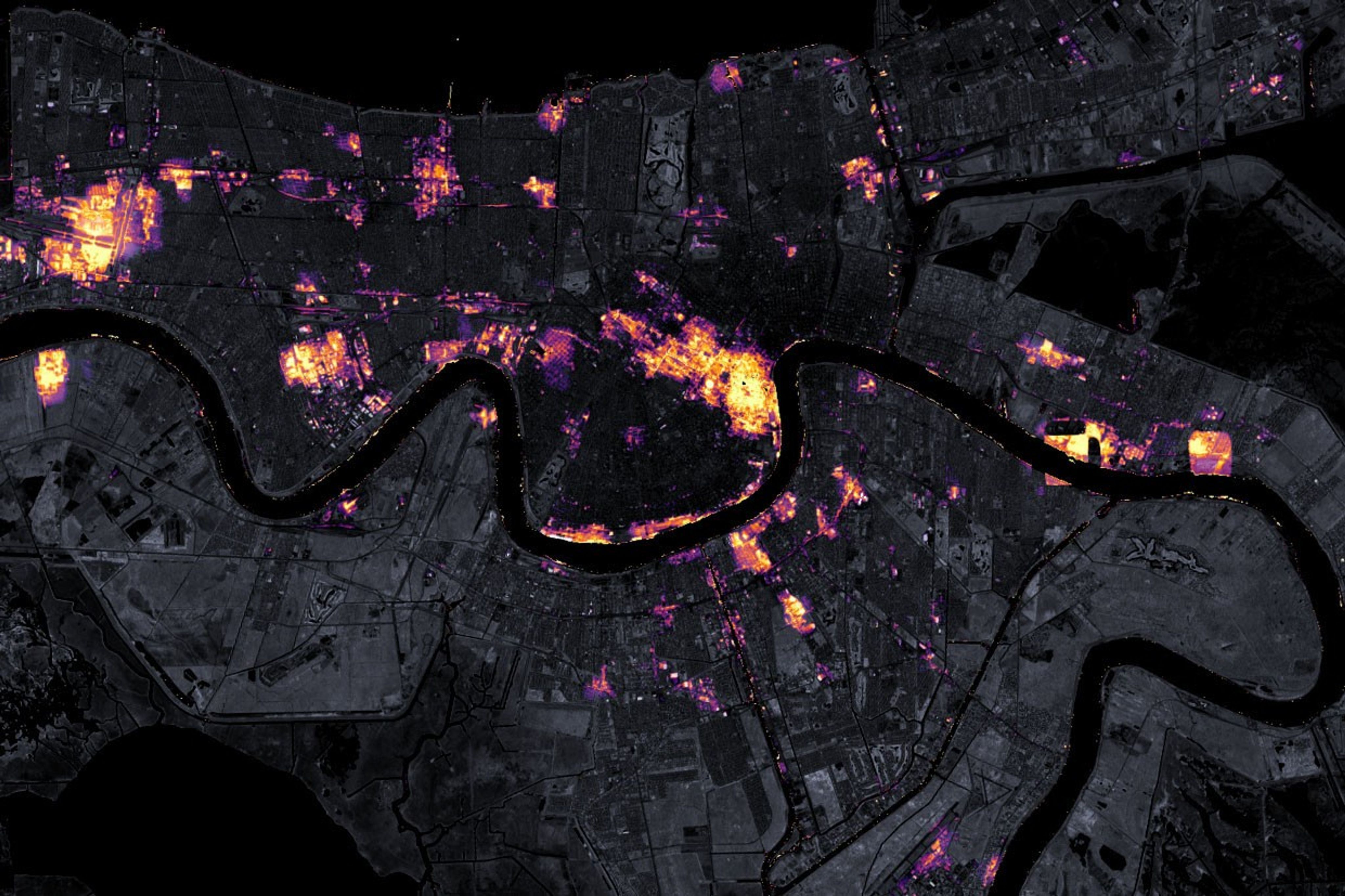
During Hurricane Ida, while first responders and other organizations addressed the storm’s impacts from the ground, the NASA Disasters program was able to provide a multitude of remotely sensed products. Some of the products and models included information on changes in soil moisture, changes in vegetation, precipitation accumulations, flood detection, and nighttime lights to help identify areas of power outages.
Before and After
Satellite Observes Power Outages in New Orleans
August 9, 2021 – August 31, 2021
The NASA team shared the data with its partners on the NASA Disasters Mapping Portal and began participating in cross-agency coordination calls to determine how to further aid response efforts. To further connect and collaborate using open science efforts, NASA Disasters overlaid publicly uploaded photos on their Damage Proxy Maps to provide situational awareness of on-the-ground conditions before, during, and after the storm.
Immediate post-storm response is critical to saving lives; just as making informed, long- term response decisions are critical to providing equitable recovery solutions for all. One example of how this data can be used is blue tarp detection in the aftermath of Hurricane Ida.
Using artificial intelligence (AI) with NASA satellite images, the Interagency Implementation and Advanced Concepts Team (IMPACT), based at NASA’s Marshall Space Flight Center in Huntsville, Alabama, conducted a study to detect the number of blue tarps on rooftops in the aftermath of hurricanes, such as Ida, as a way of characterizing the severity of damage in local communities.

While disasters cannot be avoided altogether, timely and accessible information helps communities worldwide reduce risk, improve response, hasten recovery, and build disaster resilience.
Through an initiative led by NASA’s Office of the Chief Science Data Officer, NASA and IBM are developing five open-source artificial intelligence foundation models trained on NASA’s expansive satellite repositories. This effort will help make NASA’s vast, ever-growing amounts of data more accessible and usable. Leveraging NASA’s AI expertise allows users to make faster, more informed decisions. User applications of the Prithvi Earth Foundation Models could range from identifying flood risks and predicting crop yields to forecasting long range atmospheric weather patterns.
“NASA is dedicated to ensuring that our scientific data are accessible and beneficial to all. Our AI foundation models are scientifically validated and adaptable to new data, designed to maximize efficiency and lower technical barriers. This ensures that even in the face of challenging disasters, response teams can be swift and effective,” said Kevin Murphy, NASA’s chief science data officer. “Through these efforts, we’re not only advancing scientific frontiers, but also delivering tangible societal benefits, providing data that can safeguard lives and improve resilience against future threats.”
Hear directly from some of the data scientists building these AI models, the NASA disaster response team, as well as hurricane hunters that fly directly into these devastating storms on NASA’s Curious Universe podcast.
Learn more about NASA’s AI for Science models at https://science.nasa.gov/artificial-intelligence-science/.


